


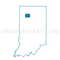
MONROE 02, Pulaski County, Indiana
About
Outline

Summary
| Unique Area Identifier | 580218 |
| Name | MONROE 02 |
| County | Pulaski County |
| State | Indiana |
| Area (square miles) | 3.37 |
| Land Area (square miles) | 3.26 |
| Water Area (square miles) | 0.11 |
| % of Land Area | 96.81 |
| % of Water Area | 3.19 |
| Latitude of the Internal Point | 41.04811900 |
| Longtitude of the Internal Point | -86.57988490 |
Maps


Graphs
Select a template below for downloading or customizing gragh for MONROE 02, Pulaski County, Indiana


Neighbors
Neighoring Voting District (by Name) Neighboring Voting District on the Map
- HARRISON, Pulaski County, IN
- MONROE 01, Pulaski County, IN
- MONROE 03, Pulaski County, IN
- MONROE 04, Pulaski County, IN